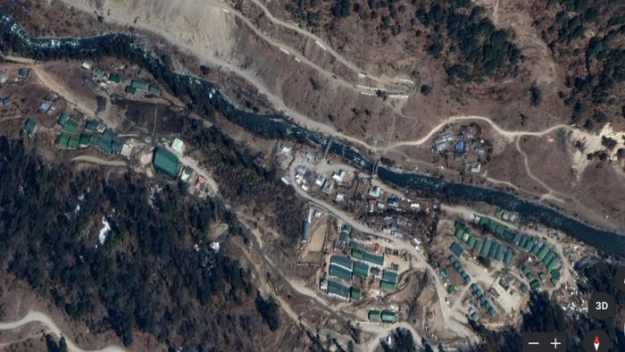
Arunachal: Army post at 17k ft has view into Tibet, China targets to occupy peak
ITANAGAR: A month ago when Indian and Chinese trooped stood against each other along the Line of Actual Control (LAC) in Arunachal Pradesh, the bone of contention was control of a 17,000 feet high peak that provides commandeering view on both sides of the border.

- Nov 01, 2021,
- Updated Nov 01, 2021, 12:21 AM IST
ITANAGAR: A month ago when Indian and Chinese trooped stood against each other along the Line of Actual Control (LAC) in Arunachal Pradesh, the bone of contention was control of a 17,000 feet high peak that provides commandeering view on both sides of the border. According to reports by The Tribune, the peak has been the target of the People’s Liberation Army of China.
PLA came close to one of the access routes of the Indian Army to the top of the peak.
The location is of such strategic importance that the Indian Army and the PLA each have estimated 3,000-3,500 men on either side of Yangtse area.
ALSO READ: Five YouTubers die as car collides truck in Darrang District
Informing this, Journalist Ajay Banerjee tweeted, "
class="css-901oao css-16my406 r-poiln3 r-bcqeeo r-qvutc0"> Army post at 17,200 ft Arunachal has view into Tibet, irks PLA for long. Google earth images PLA's main garrison with coordinates and Indian base ( not the post) w/o coordinatesUnmanned aerial vehicles keep an eye and long-range sensors provide real-time images. Both sides have a network of roads and tracks along the LAC to counter patrol parties, The Tribune reported.
The peak provides a commanding view of Tibet across the LAC. India is in firm control to the top and its access routes from own side. The Yangtse area is part of the wider area, which the military terms as ‘Mago-Chuna’. The Nuranang river meanders into India from Tibet close to the mountain spur where the peak is situated.