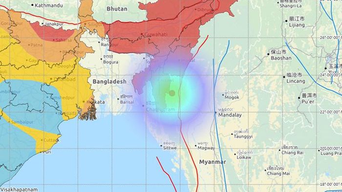
Earthquake measuring 4.6 on Richter scale jolts Mizoram

- Jul 03, 2020,
- Updated Jul 03, 2020, 12:48 AM IST
An earthquake of magnitude 4.6 on the Richter scale hit Mizoram at 2:35 pm on July 3rd, 2020. The epicentre of the earthquake was at 52 km South South-East (SSE) of Champhai, Mizoram and 25 km depth, according to the National Center for Seismology (NCS).
On June 24th, 2020, an earthquake of magnitude 4.1 on the Richter scale hit Mizoram at 8:02 am. The epicentre of the earthquake was at 31 km South South-West (SSW) of Champhai, Mizoram and 10 km depth, according to the National Center for Seismology (NCS).
Earlier at 11:03 ppm on June 23rd, 2020, an earthquake measuring 3.2 on the Richter scale hit the state. The epicenter of the earthquake was at 70 km South South-East (SSE) of Champhai, Mizoram and 10 km depth, according to the NCS.
Also read: Earthquake hits Mizoram for second time in 9 hours, this time 4.1 on Richter scale
The state has been witnessing such earthquakes for a few days. Mizoram Chief Minister Zoramthanga on June 22nd, 2020, said that two earthquakes hit the state within a span of 12 hours. On June 22nd, 2020, an earthquake of magnitude 5.5 on the Richter scale hit 27 km south-southwest of Chmapai at 4.10 am. Another earthquake of magnitude 5.1 on the Richter scale hit 25 km east-north-east of Aizawl at 4.16 pm on June 21, as per ANI report. On June 18, an earthquake of a magnitude of 5.0 on the Richter scale hit 98 km south-east (SE) of Champhai.
On June 18th, 2020, a medium intensity quake pegged at a magnitude of 5 rocked northeastern states. In a statement, the Regional Seismic Centre said that the tremor was tracked at a depth of 80 km from the earth’s surface with the epicentre in Mizoram’s Champai district. The earthquake was felt in Shillong and all major cities in the northeast.
Readers like you make Inside Northeast’s work possible.
To support our brand of fearless and investigative journalism, support us HERE.
Download:
The Inside Northeast app HERE for News, Views, and Reviews from Northeast India.
Do keep following us for news on-the-go. We deliver the Northeast.